Các nhà khoa học đã sử dụng ảnh vệ tinh (ảnh viễn thám), kỹ thuật không gian địa lý,... read more
Bí mật là có hàng tá nguồn có thẩm quyền với hình ảnh vệ tinh chất lượng cao. Bạn... read more
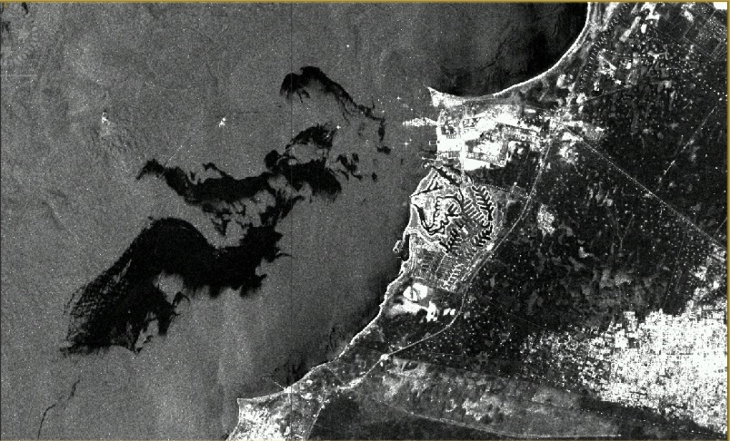
Ô nhiễm tràn dầu là một trong những vấn đề môi trường biển nghiêm trọng nhất hiện nay, nhất... read more
Thông thường, các nhà thẩm định tài sản đối mặt với những thay đổi của thế giới. Ví dụ... read more
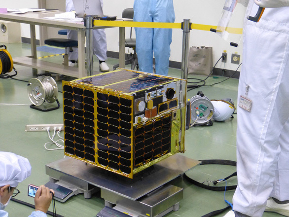
MicroDragon là vệ tinh đầu tiên chính thức do đội ngũ nhà khoa học, kỹ sư Việt Nam chế... read more
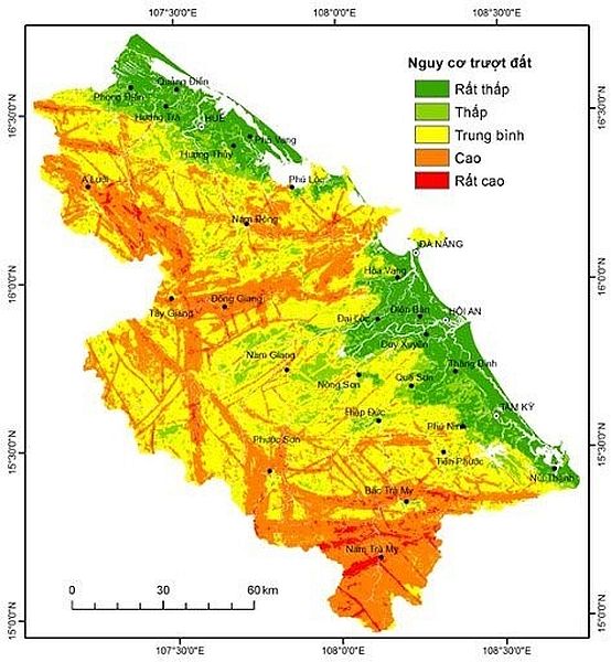
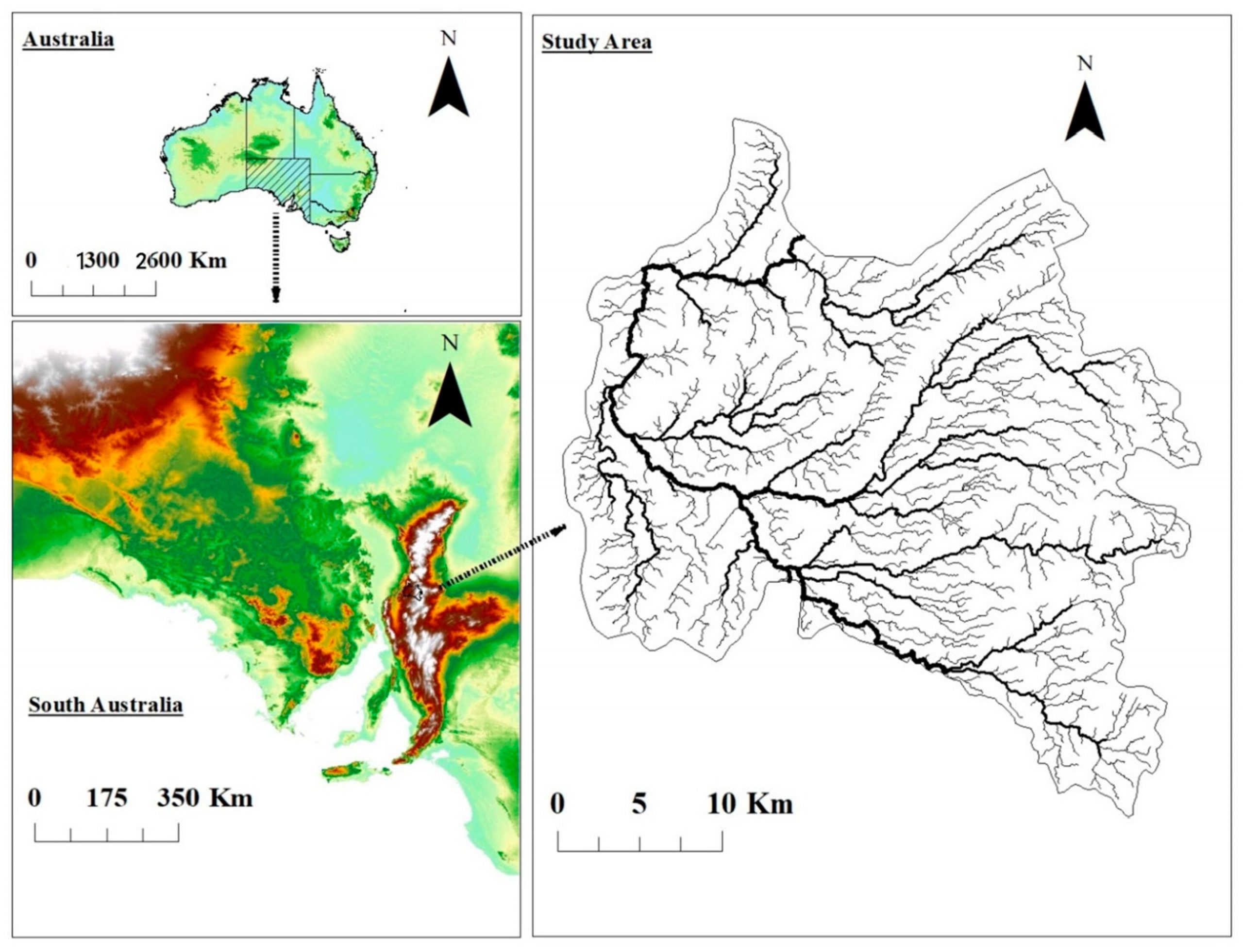
Công nghệ viễn thám, công nghệ GIS đã được ứng dụng nhiều trong dự báo sạt lở bờ sông... read more

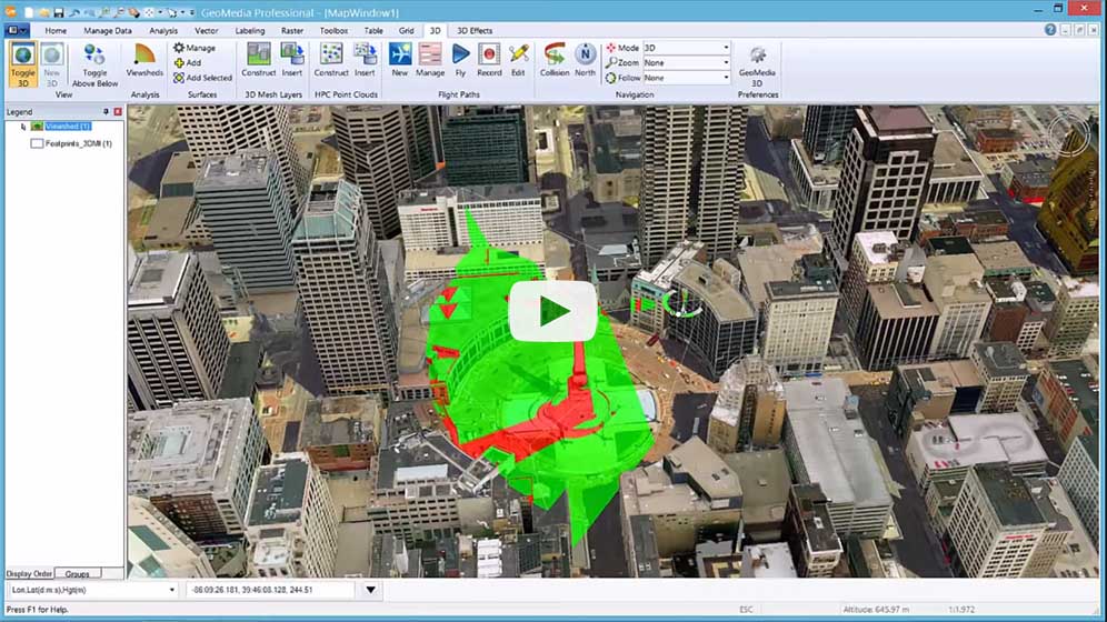
Nghiên cứu mới từ Routescene cho thấy giá trị của dữ liệu đám mây điểm UAV-LiDAR đối với hoạt... read more
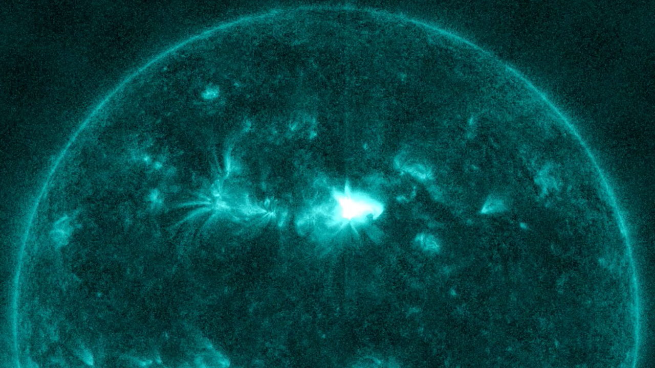
Hai trong số 17 vụ phun trào mặt trời xuất phát từ một vết đen duy nhất trên mặt... read more

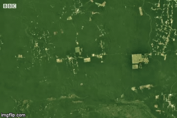
Các nhà nghiên cứu sử dụng dữ liệu vệ tinh radar độ phân giải cao để phát hiện hàng... read more
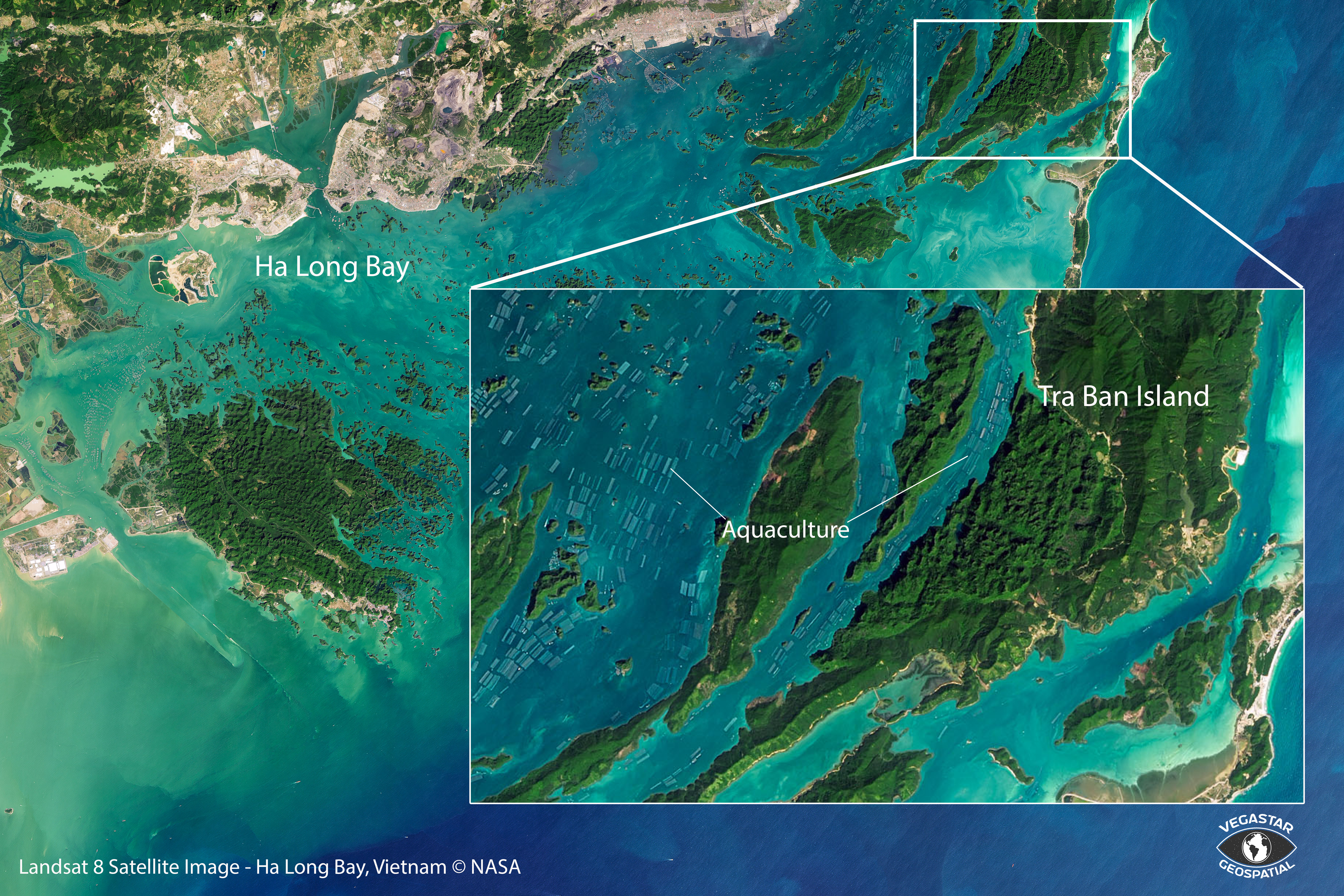
Ứng dụng ảnh viễn thám trong giám sát tài nguyên đất. Lựa chọn công nghệ viễn thám là giải pháp ưu tiên... read more