Giám sát, phòng chống hạn hán nhờ công nghệ viễn thám
Công nghệ viễn thám với những ưu điểm nổi bật so với các phương pháp nghiên cứu truyền thống đã được ứng dụng hiệu quả trong nghiên cứu, giám sát và ứng phó với hiện tượng hạn hán.
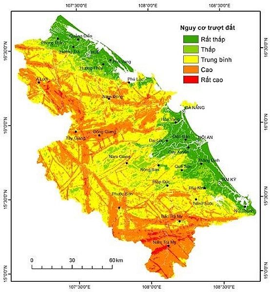
Hạn hán là một hiện tượng tự nhiên gây ảnh hưởng nghiêm trọng đến môi trường sống và hoạt động sản xuất của người dân. Hạn hán được đánh giá là thiên tai gây thiệt hại nặng nề đứng thứ 3 say lũ, bão và có xu hướng xảy ra gay gắt, khó kiểm soát hơn do tác động của biến đổi khí hậu. Ở Việt Nam, hạn hán xảy ra ở hầu khắp cả nước với mức độ và thời gian khác nhau, trong đó đặc biệt nghiêm trọng là khu vực miền Trung và Tây Nguyên, gây ra những thiệt hại to lớn đối với kinh tế- xã hội.
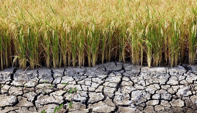
Hạn hán tác động đến môi trường như hủy hoại các loài thực vật, các loài động vật, quần cư hoang dã, làm giảm nguồn chết lượng không khí, nước, gây cháy rừng, xói lở đất. Các tác động này có thể kéo dài và không khôi phục được. Hạn hán tác động đến kinh tế xã hội như giảm năng suất cây trồng, giảm diện tích gieo trồng, giảm sản lượng cây trồng, chủ yếu là sản lượng cây lương thực. Tăng chi phí sản xuất nông nghiệp, giảm thu nhập của lao động nông nghiệp. Tăng giá thành và giá cả các lương thực. Giảm tổng giá trị sản phẩm chăn nuôi. Các nhà máy thủy điện gặp nhiều khó khăn trong quá trình vận hành, đặc biệt là ảnh hưởng nguồn nước và trong sản xuất nông nghiệp.
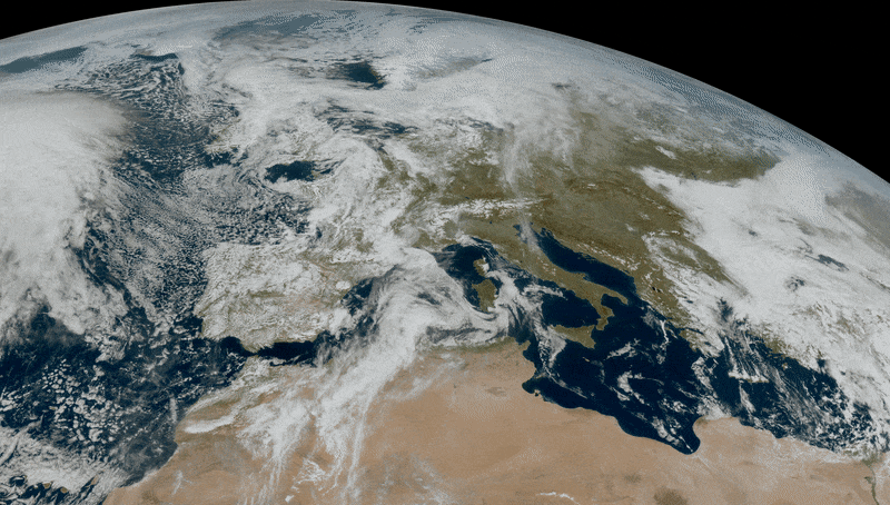
Hạn hán thường xảy ra trên diện rộng, do vậy việc quan trắc và nghiên cứu bằng các phương pháp truyền thống gặp rất nhiều khó khăn, và trên thực tế không thể đặt các trạm quan trắc với mật độ dày đặc do chi phí lớn. Dữ liệu viễn thám cung cấp thông tin về bề mặt Trái Đất ở các kênh phổ khác nhau và độ phủ trùm rộng đã được sử dụng hiệu quả trong quan trắc và giám sát hạn hán. Đã có rất nhiều nghiên cứu trên thế giới sử dụng tư liệu viễn thám hồng ngoại nhiệt trong xác định nhiệt độ và độ ẩm đất nhằm đánh giá mức độ khô hạn của bề mặt.
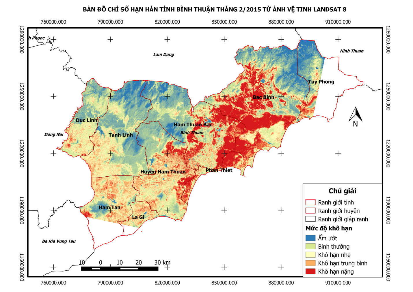
Ảnh hồng ngoại nhiệt LANDSAT 8 với độ phân giải không gian trung bình (15-30m) cung cấp thông tin rõ ràng hơn về sự thay đổi độ ẩm bề mặt so với ảnh MODIS, NOAA/AVHRR, do vậy có thể được sử dụng hiệu quả trong nghiên cứu và giám sát hiện tượng hạn hán. Việc sử dụng các số liệu từ các vệ tinh quan trắc Trái Đất rất có ích và rát đáng được quan tâm, các dữ liệu vệ tinh viễn thám luôn có sẵn và có thể được sử dụng để phát hiện sự khởi đầu của khô hạn, cả về thời gian và cường độ.
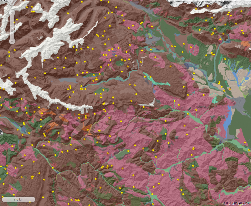
Có thể thấy, viễn thám và GIS được coi là một công cụ phổ biến trong việc xây dựng các thông tin về vùng bị hạn và sự xuất hiện của hạn. Ví dụ, trường đại học Khon Kaen, Thái Lan đã ứng dụng công nghệ GIS và Viễn thám để mô hình hoá các khu vực hạn thuộc vùng Đông Bắc của nước này. Vùng Đông Bắc Thái Lan có tổng diện tích tự nhiên vào khoảng 170,000 km2, chiếm 1/3 diện tích lãnh thổ. Mô hình này đã được phát triển để xây dựng bản đồ hạn.
GIS đã được sử dụng để xây dựng các lớp bản đồ hạn ứng với các nguyên nhân gây hạn khác nhau. Hạn được coi là hàm của lượng mưa, chế độ thuỷ văn và đặc điểm địa hình trong vùng, 3 lớp bản đồ tương ứng với 3 nguyên nhân gây hạn đã được xây dựng. Mỗi lớp bao gồm các đặc điểm địa lý và thuộc tính của nó được dùng làm các dữ liệu đầu vào để phân tích. Ví dụ, thiếu nước do điều kiện khí tượng được phân tích dựa vào lượng mưa trung bình năm của 15 năm nhỏ nhất tại 264 trạm đo. Thiếu nước do chế độ thuỷ văn được phân tích dựa vào chu trình nước mặt, vùng được tưới, mật độ của sông suối, chất lượng và khối lượng nước ngầm. Thiếu nước do đặc điểm địa hình được xây dựng kết hợp từ các thông tin không gian về loại đất, điều kiện tiêu thoát và sử dụng đất. Các thông tin này được thu thập thực tế và ảnh Landsat TM, bao gồm lượng nước mặt, sử dụng đất, loại đất và tình trạng tiêu thoát. Một phần khác là từ các bản đồ của cơ quan Chính phủ.
Nguồn: Tổng hợp