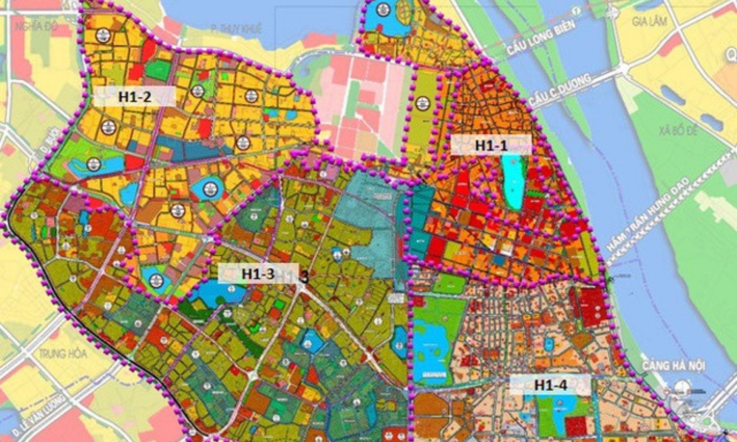
Provide remote sensing and GIS data solutions for regional and local planning.
Using geospatial data for the purposes of land... read more
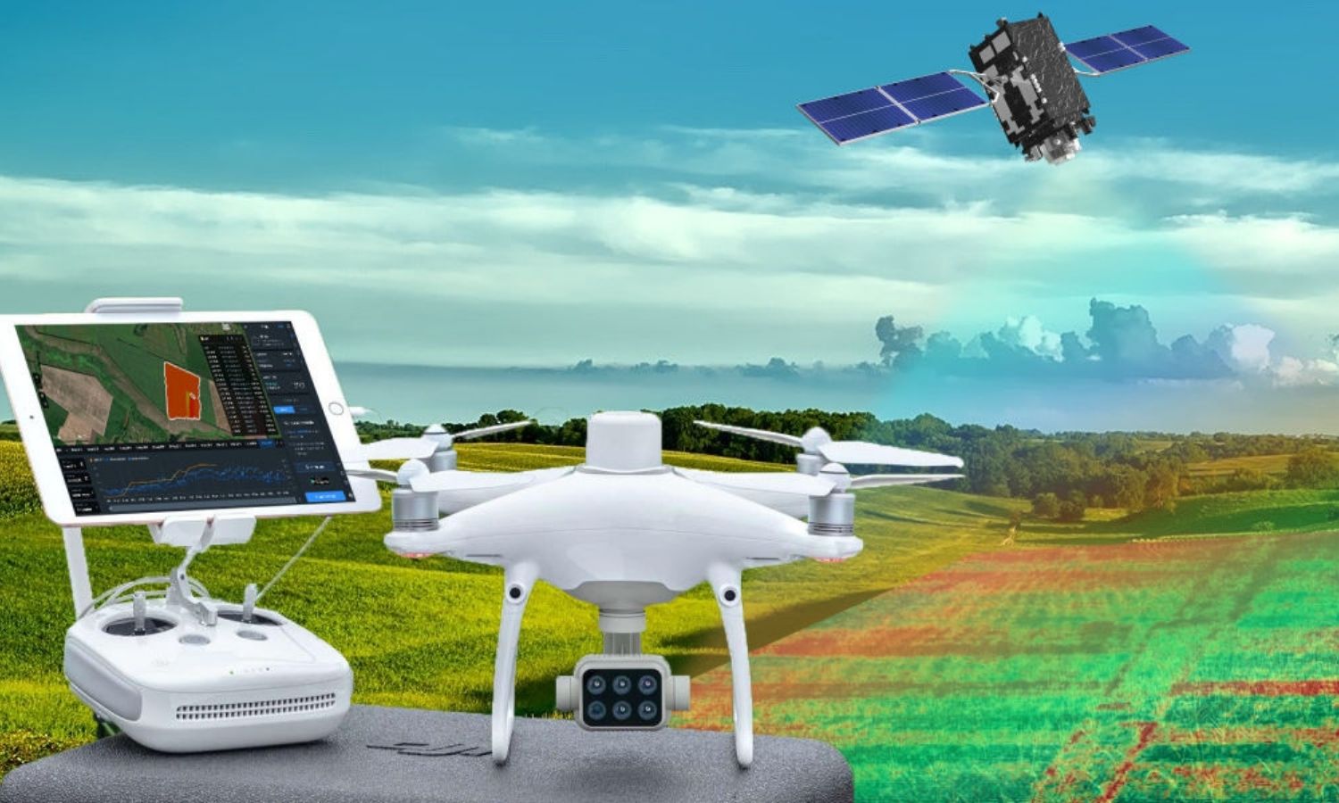
Research and development solutions for traceability and yield estimation in agriculture. Geospatial data performs the task of direct observation... read more
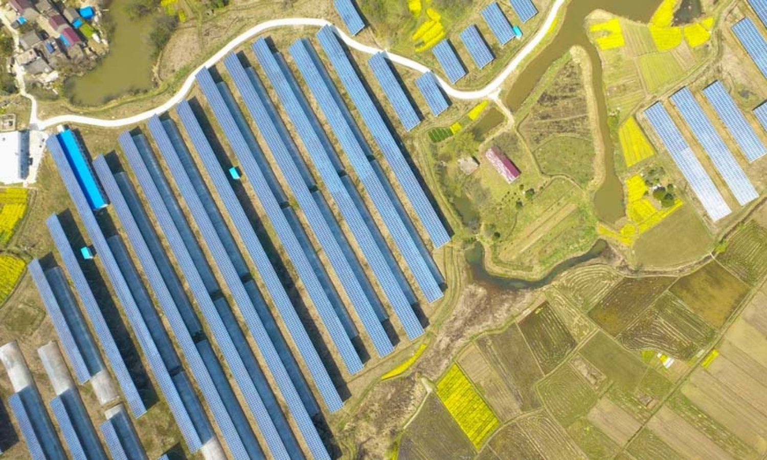
Research and use satellite data in exploiting and developing potential alternative electric energies solar energy, wind energy…
Satellite data provides... read more
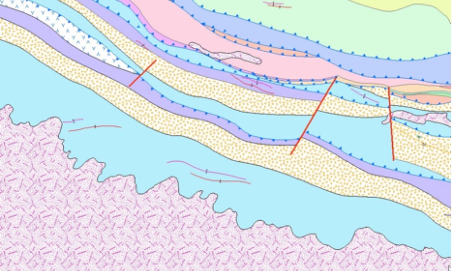
Providing remote sensing solutions and services to support geological and geostructural monitoring and mapping, mineral and water exploration, hydrocarbon... read more
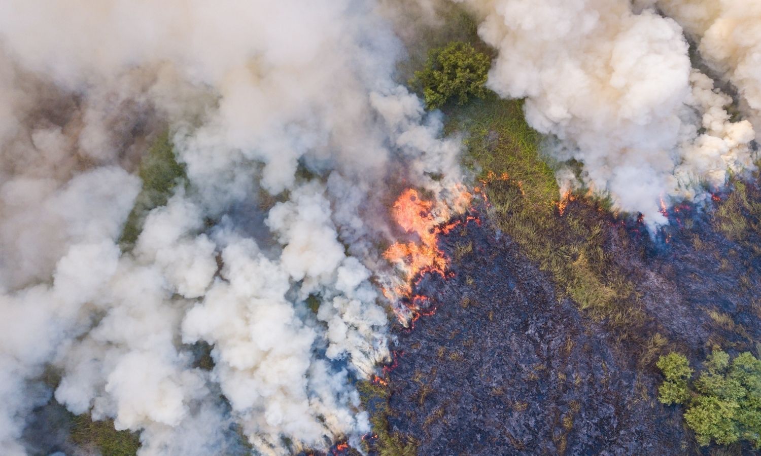
Provide emergency services from satellite data such as search and rescue, timely response to natural disasters, forest fire detection.
Prepare... read more
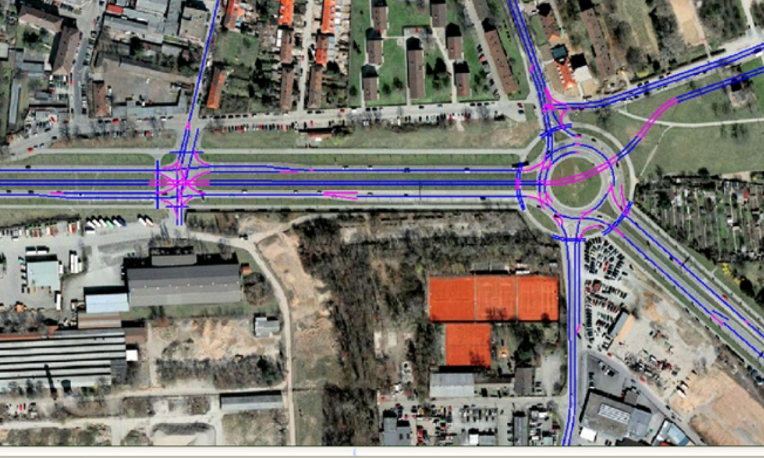
Providing solutions and services of remote sensing – geospatial in the task of planning and construction of the transport... read more

Providing marketing consulting services for geospatial remote sensing products and GIS technology
Building geodatabase, infrastructure
Build a database that includes business... read more

Providing remote sensing solutions, geographic information (GIS), and data digitization services, supporting content editing for reports and surveys.
Provide satellite... read more
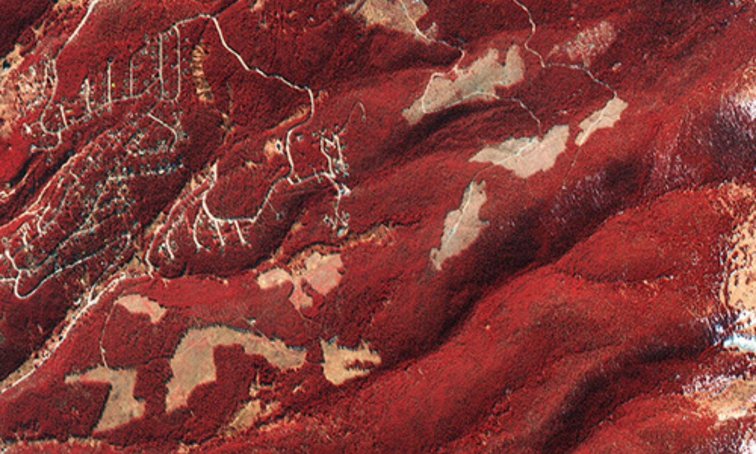
Providing solutions, services & software for remote sensing, geospatial for forest management.
Map of detecting land changes, monitoring and monitoring... read more

Provide disaster risk monitoring and management system. Remote sensing solution allows to monitor crops, prepare crop insurance, estimate agricultural... read more