Drone hỗ trợ công tác tìm kiếm cứu nạn và phòng cháy chữa cháy rừng
Với công dụng tuyệt vời của mình, máy bay điều khiển từ xa drone có thể là trợ thủ đắc lực trong tìm kiếm cứu nạn vùng xảy ra lũ lụt, thiên tai và giám sát biến động, phòng cháy chữa cháy rừng.
Khái niệm máy bay không người lái UAV, Drone, Flycam
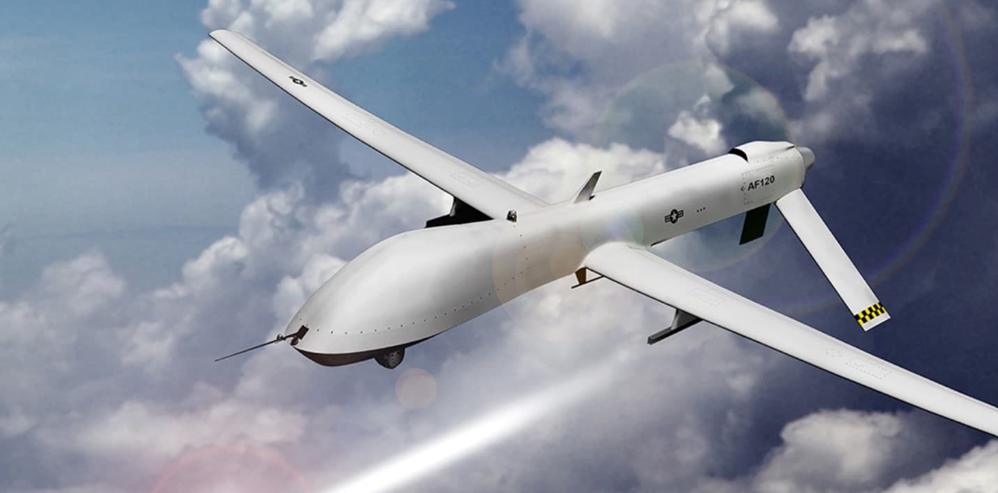
Máy bay không người lái (UAV – unmanned aerial vehicle) là thiết bị không có phi công trong buồng lái, hệ thống bao gồm một máy bay không người lái và 1 kiểm soát viên trên mặt đất và một hệ thống liên lạc giữa UAV và kiểm soát viên. UAV có thể được kiểm soát bằng con người vận hành hoặc máy tính dựa vào một hệ thống tự động.
UAV ban đầu được sinh ra để phục vụ trong lĩnh vực quân sự từ những năm 1950 với tên gọi là UAS (unmanned aircraft system) phục vụ cho việc do thám, trinh sát chiến trường. Thiết bị này nhanh chóng được chuyển sang dân dụng phục vụ các lĩnh vực thương mại, khoa học, giải trí, nông nghiệp và các ứng dụng khác như giám sát, bảo vệ, giao hàng, chụp ảnh trên không, kiểm tra cơ sở hạ tầng. Hiện nay việc sử dụng UAV dân sự đang có xu hướng ngày càng mở rộng.
Phương tiện bay kiểu mới, được chế tạo đa dạng, có kích thước nhỏ đến trung bình được gọi là drone. Drone có thể bao gồm nhiều kích thước, hình dạng và đảm nhiệm nhiều vai trò khác nhau.
Ứng dụng của Drone trong cuộc sống hàng ngày:
- Quay phim, chụp ảnh từ trên cao. Phổ biến trong lĩnh vực nhiếp ảnh với tên gọi là Flycam
- Các Drone có tích hợp hệ thống quét laser như LIDAR có tác dụng hỗ trợ quá trình xây dựng bản đồ địa hình, nhất là bản đồ 3D.
- Rải phân bón, phun thuốc trừ sâu trong lĩnh vực nông nghiệp.
- Hỗ trợ công tác quản lý vận hành lưới điện
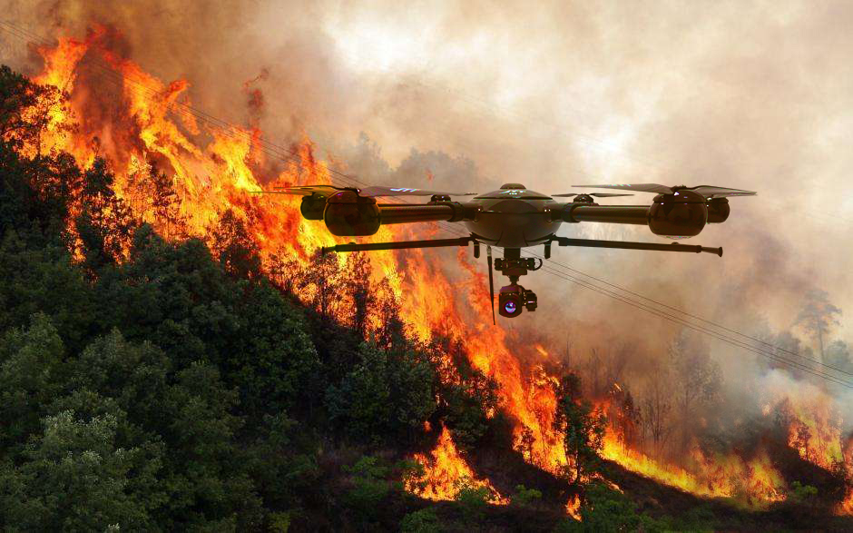
- Hỗ trợ công tác giám sát quản lý rừng, phòng cháy chữa cháy rừng
- Drone gắn thêm cảm biến nhiệt thường được sử dụng cho mục đích tìm kiếm, cứu nạn.
- Shipper giao thức ăn, đồ tạp hoá từ trên cao.
- Vận chuyển hàng hoá, thuốc men, đồ cứu trợ.
Ứng dụng trong Lâm nghiệp
Drone/UAV ứng dụng trong Lâm nghiệp ngày càng đa dạng, với khả năng bay cao, xa và các ứng dụng điều khiển tự động đã giúp cho người dùng sử dụng thiết bị drone trong giám sát rừng ngày càng hiệu quả. Hiện nay, một số địa phương đã trang bị thiết bị này phục vụ theo dõi diễn biến rừng nhằm phát hiện sớm hoặc kiểm tra thông tin các vụ mất rừng tại các khu vực vùng sâu, vùng xa nơi con người khó tiếp cận. Ngoài ra, Drone cũng giúp nắm bắt tình hình cháy rừng hiện tại, thông qua việc cung cấp hình ảnh trực tiếp của đám cháy giúp cho việc chỉ đạo chữa cháy được hiệu quả.
Mô hình sử dụng Drone/UAV ứng dụng trong lâm nghiệp có thể được hiểu đơn giản bao gồm các bước như sau:
- Lập trình đường bay
- Thực hiện bay
- Ghép ảnh và nắn ảnh
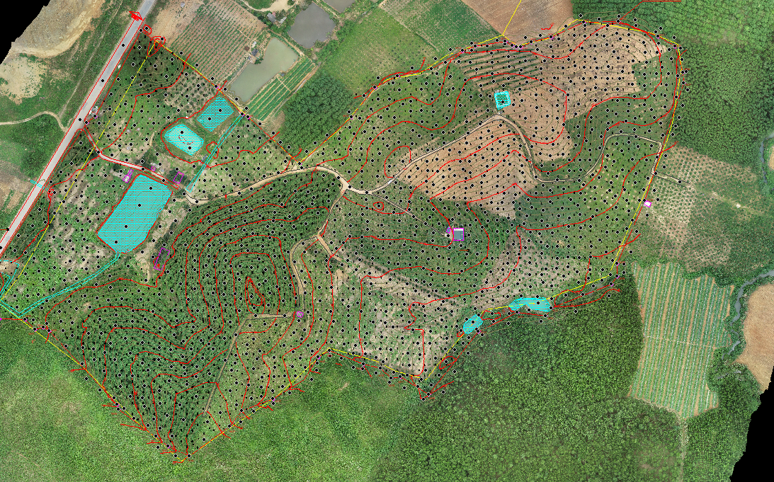
Ứng dụng trong đo đạc, khảo sát (trắc địa)
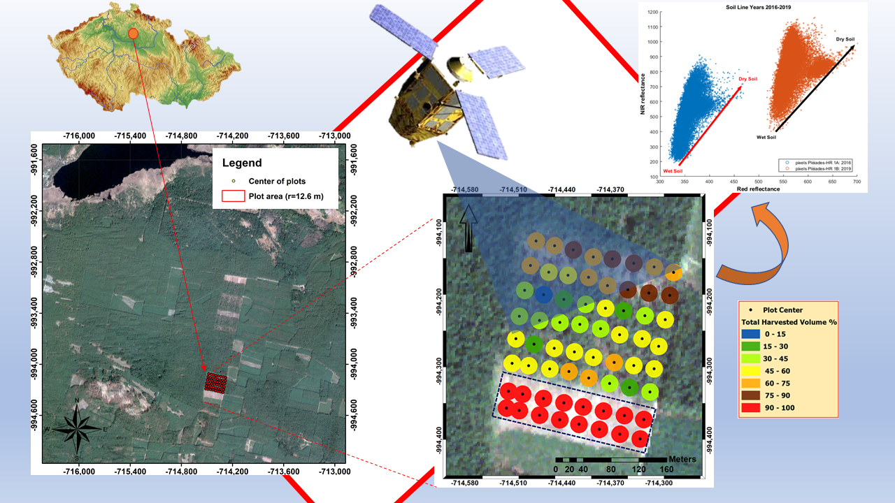
Drone ra đời đã giúp cho việc thực hiện khảo sát, đo đạc hiện trường được thực hiện nhanh chóng với độ chính xác ngày càng cao. Theo chuyên gia, với độ cao dưới 300m, độ phân giải cao có thể đạt từ 12 – 3 cm cho mỗi pixel, độ chính xác đạt được lên tới 5 cm, với thiết bị với tốc độ bay đạt 15 m/s thì có thể đạt được việc khảo sát trên 300 ha/thiết bị/ngày (DJI Phantom 4). Việc bay chụp ở tầm thấp cho độ chính xác cao và việc khống chế các điểm định vị cũng được thực hiện tốt hơn nhằm hạn chế các sai số. Có thể lựa chọn thời điểm bay chụp do vậy hạn chế được các ảnh hưởng của thời tiết, ảnh hưởng của mây và khí quyển.
Trong trắc địa công trình, người ta sử dụng drone để kiểm tra các công trình ở những vị trí khó nhằm phát hiện kịp thời các lỗi trong quá trình xây dựng. Đây là giải pháp giám sát công trình xây dựng đã được ứng dụng nhiều ở các nước phương Tây, tại Việt Nam cũng đã có những tập đoàn lớn đã áp dụng.
Trong ngành điện sử dụng drone để kiểm tra các trụ điện, tình trạng các đầu đấu nối nhằm kiểm tra độ an toàn để có các biện pháp bảo dưỡng kịp thời.
Ứng dụng trong điện ảnh
Những bức ảnh 3D gần với thời gian thực, hoặc những bức ảnh landscape hẳn đã làm siêu lòng bao người và hấp dẫn du khách đến khám phá. Những tác phẩm đó phần lớn phải được chụp từ flycam mới có thể đạt được những tấm ảnh với độ cao, chiều sâu ảnh và mức độ toàn cảnh của phong cảnh.
Nói về điện ảnh áp dụng drone thì nó quá nhiều và sẽ còn ngày càng nhiều để mang lại những hình ảnh đẹp, tổng quan, và dễ vào đầu khán giả nhất. Hoặc đơn giản hiện nay bệnh dịch COVID-19 đang diễn biến phức tạp ở Việt Nam thì flycam cũng được sử dụng để giám sát người dân ra đường điển hình là ở khu vực TP. Hồ Chí Minh và Đà Nẵng.
Ứng dụng trong công tác tìm kiếm cứu hộ cứu nạn
Nhờ những công dụng tuyệt vời của mình, việc ứng dụng drone vào hỗ trợ tìm kiếm, cứu hộ cứu nạn khi xảy ra thiên tai là điều vô cùng cần thiết và mang lại hiệu quả cao. Thông thường việc cứu hộ cứu nạn phải sử dụng đến máy bay trực thăng vì điều kiện địa hình khó khăn, nhưng chính như vậy lại rất tốn kém và phức tạp. Sử dụng thiết bị Drone có thể trực tiếp truyền hình ảnh từ máy bay về trung tâm cứu nạn, chính công dụng của máy bay điều khiển Drone này khiến cho nhóm tìm kiếm đến được nạn nhân nhanh hơn và tăng cao cơ hội sống sót cho người đó.
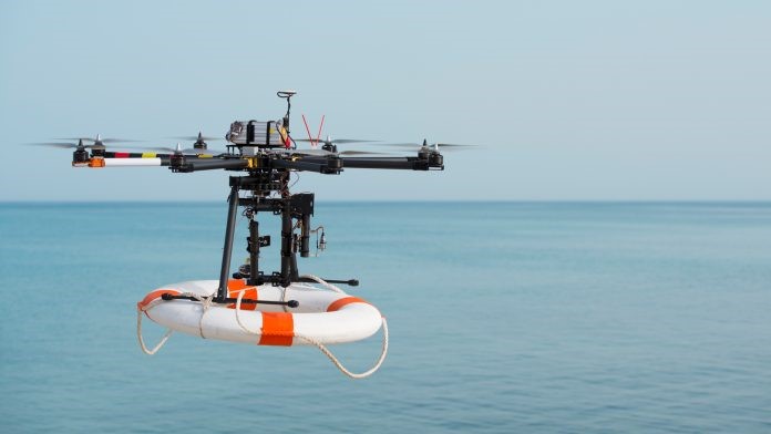
Bên cạnh đó, drone còn hỗ trợ vận chuyển hàng hoá, thuốc men và đồ cứu trợ. Ở bất kì đâu cũng vậy, thiên tai luôn là mối hiểm hoạ không thể lường trước được, và đôi khi địa hình khó khăn khiến đội cứu hộ không thể tiếp cận được với những người đang gặp nguy hiểm và thiếu thốn về lương thực, điều kiện trang thiết bị y tế. Đã có rất nhiều trận động đất, lũ lụt khiến cho một khu vực bị cô lập hoặc những vụ sập mỏ người ngoài không thể chui vào bên trong để đưa đồ tiếp tế được. Vậy nên hiện tại, sử dụng thiết bị drone sẽ khiến cho việc hỗ trợ hiệu quả hơn và an toàn hơn cho đội cứu hộ.
Việc tìm kiếm người mất tích sẽ trở nên dễ dàng hơn, nhanh hơn và ít tốn chi phí hơn nhờ máy bay không người lái chuyên dụng. Điều này có được nhờ kích thước nhỏ gọn khả năng bay linh hoạt hơn trực thăng cứu hộ, chi phí vận hành rất rẻ. Máy bay không người lái có thể dùng để dựng bản đồ hiện trạng giúp đánh giá hậu quả thiên tai và đưa ra phương án khắc phục kịp thời.
Nguồn: Tổng hợp
|
Trung tâm Công nghệ Địa không gian – Vegastar Geospatial Center
Ngoài ra, Trung tâm VegaGeos cung cấp dịch vụ ảnh viễn thám có độ phân giải cao ở các lĩnh vực như: an ninh – quốc phòng, nông – lâm nghiệp, tìm kiếm cứu nạn, quản lý tài nguyên môi trường, phát triển năng lượng, phát hiện biến đổi khí hậu và quản lý cơ sở hạ tầng. |