Providing remote sensing solutions for monitoring, making thematic maps for the task of developing the power industry.
Using remote sensing... read more
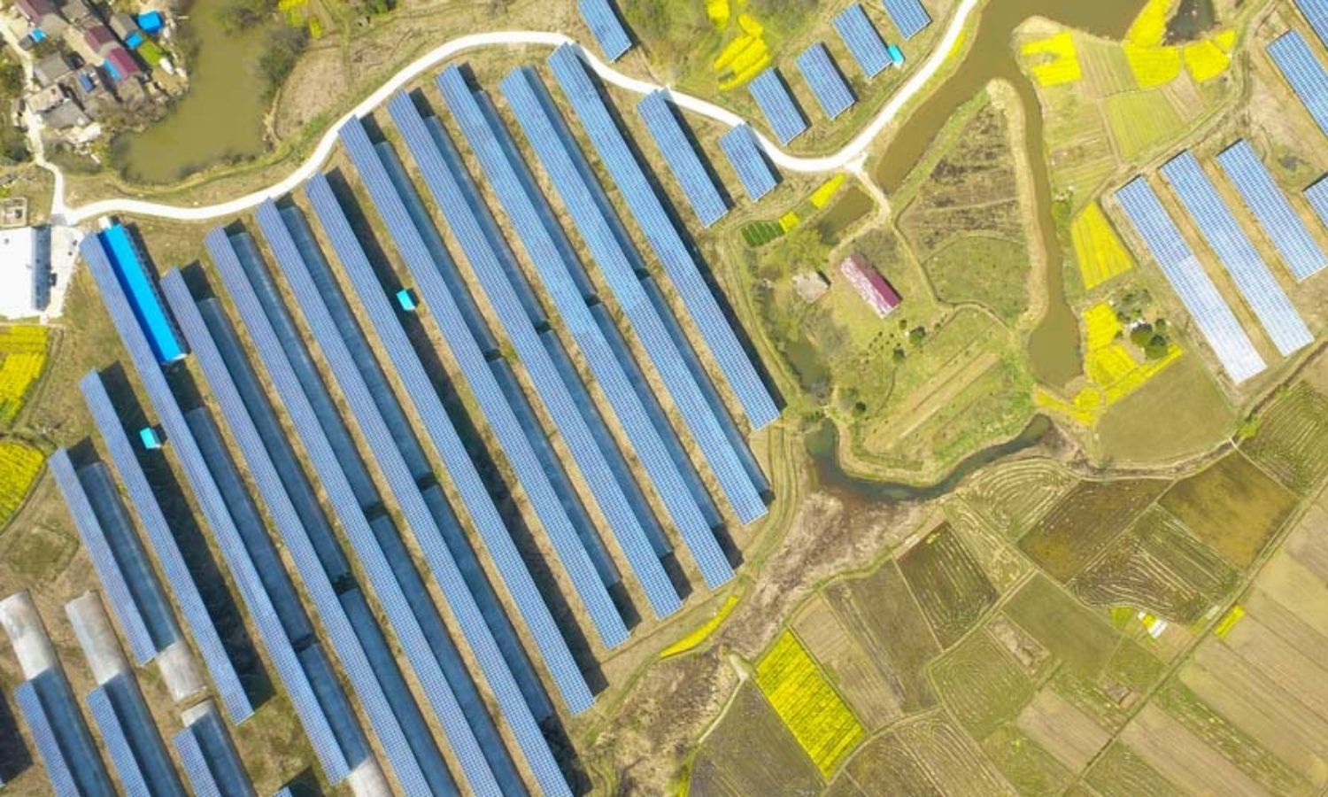
Research and use satellite data in exploiting and developing potential alternative electric energies solar energy, wind energy…
Satellite data provides... read more

Providing marketing consulting services for geospatial remote sensing products and GIS technology
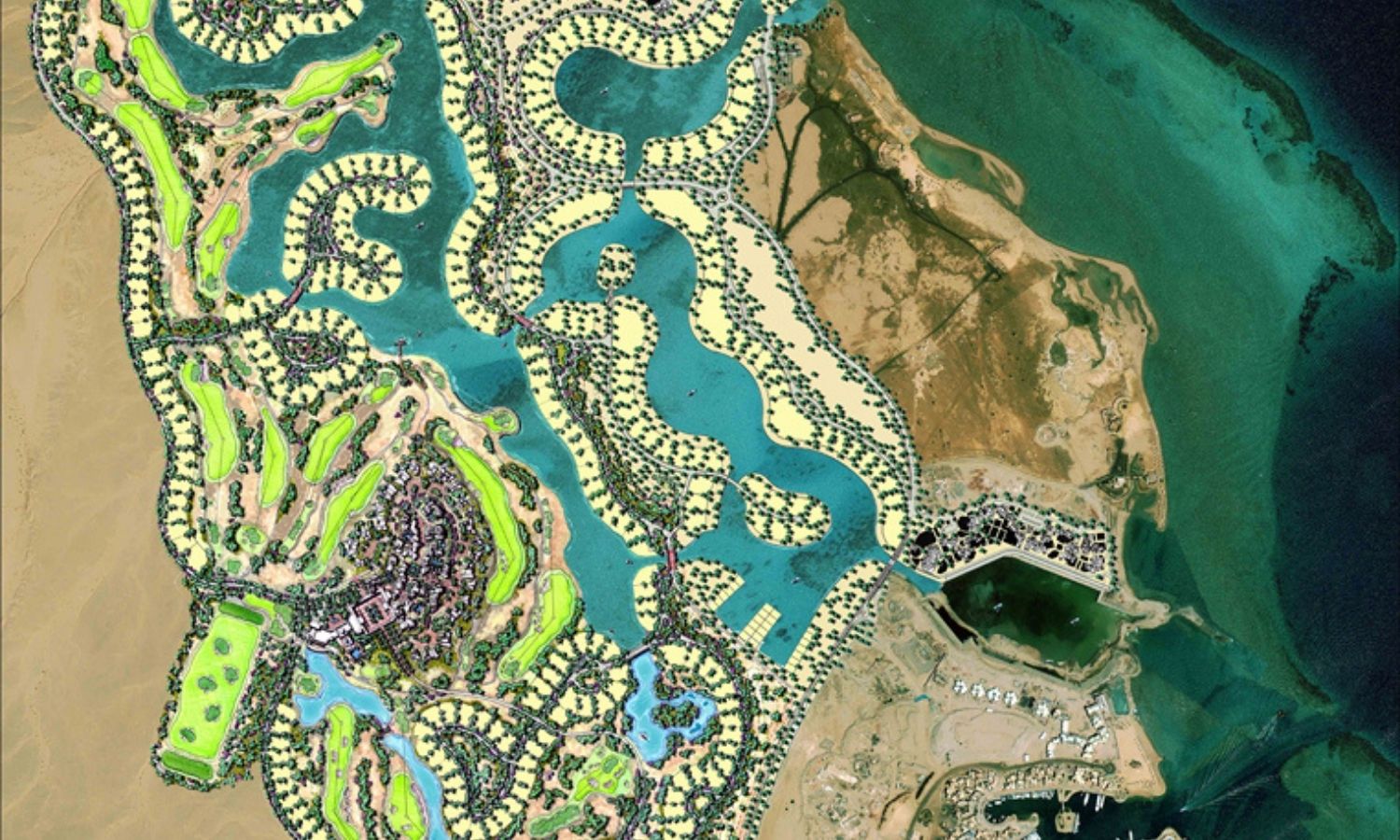
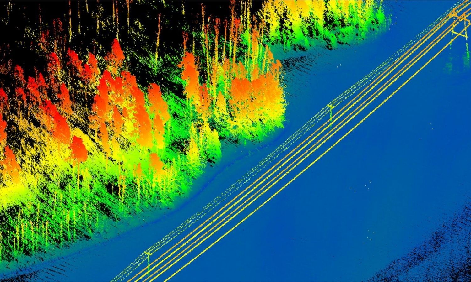
Building geodatabase, infrastructure
Build a database that includes business... read more
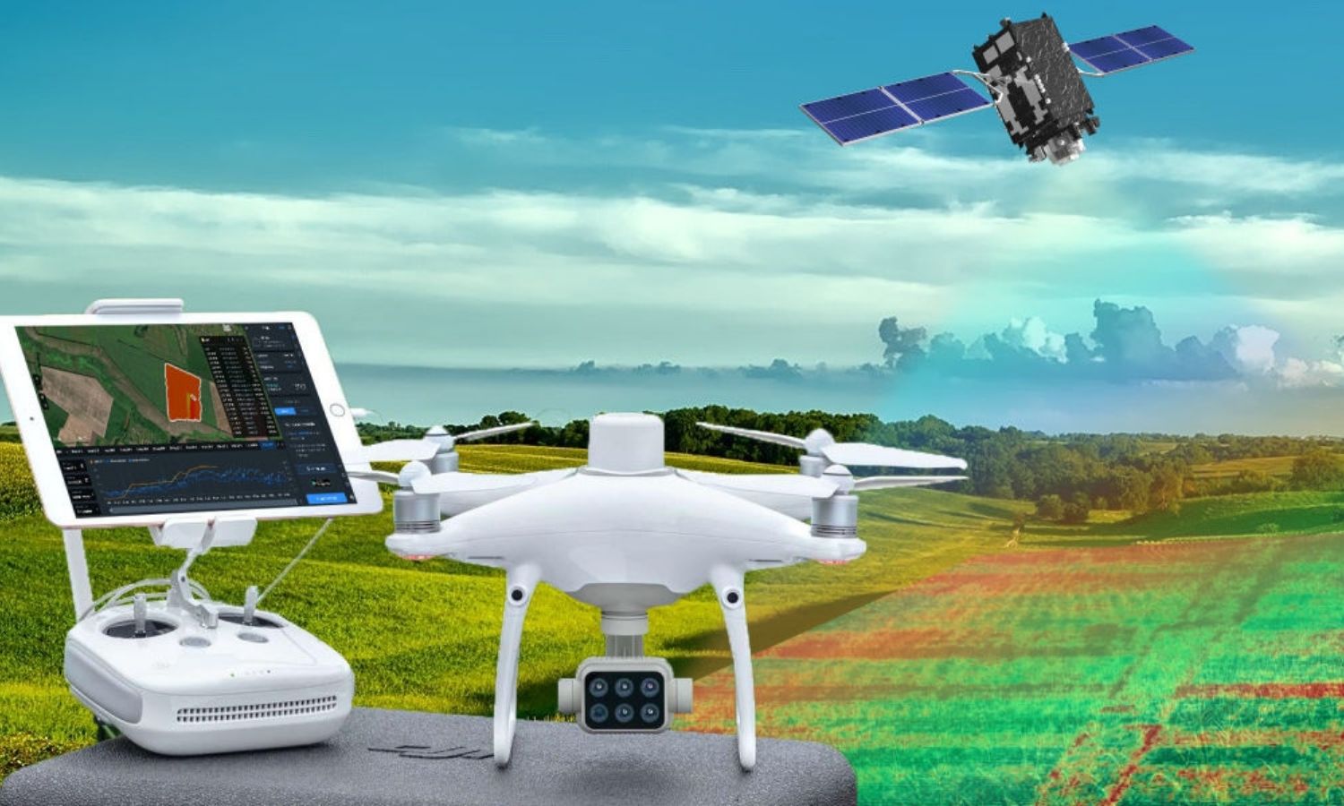
Research and development solutions for traceability and yield estimation in agriculture. Geospatial data performs the task of direct observation... read more
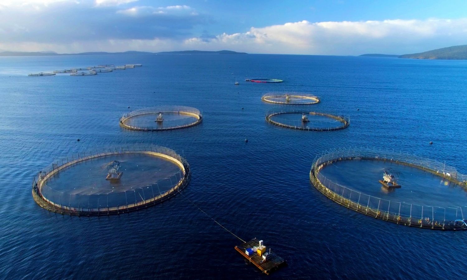
Researching software to trace output in agriculture in general and providing remote sensing and GIS solutions for aquaculture in... read more
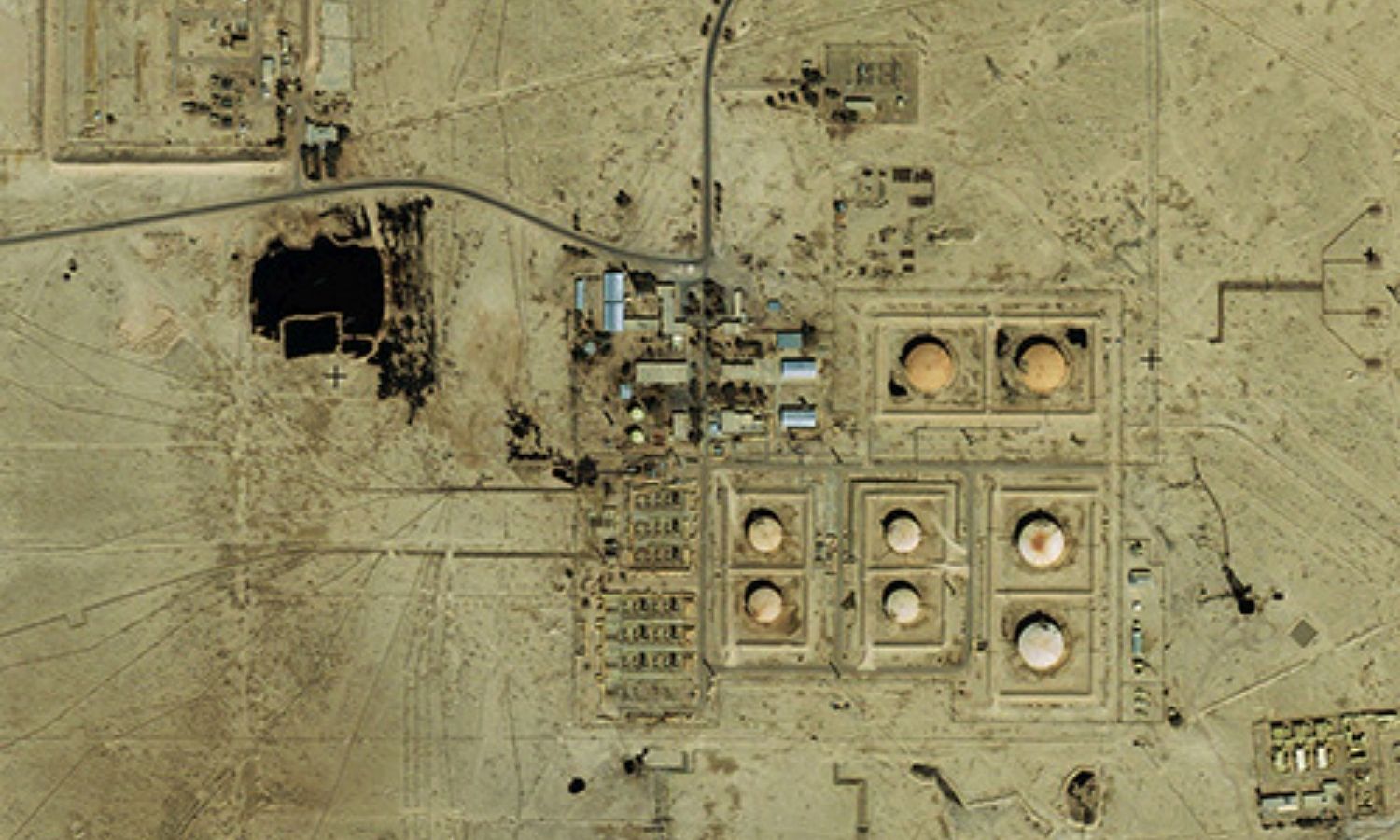
Analyzing and processing remote sensing data in potential energy exploitation and development such as oil and gas, mineral fields,... read more

Providing remote sensing solutions, geographic information (GIS), and data digitization services, supporting content editing for reports and surveys.
Provide satellite... read more
Satellite communication technology is often used in disaster response and emergency situations when land-based communications services are disrupted.
Remote sensing... read more

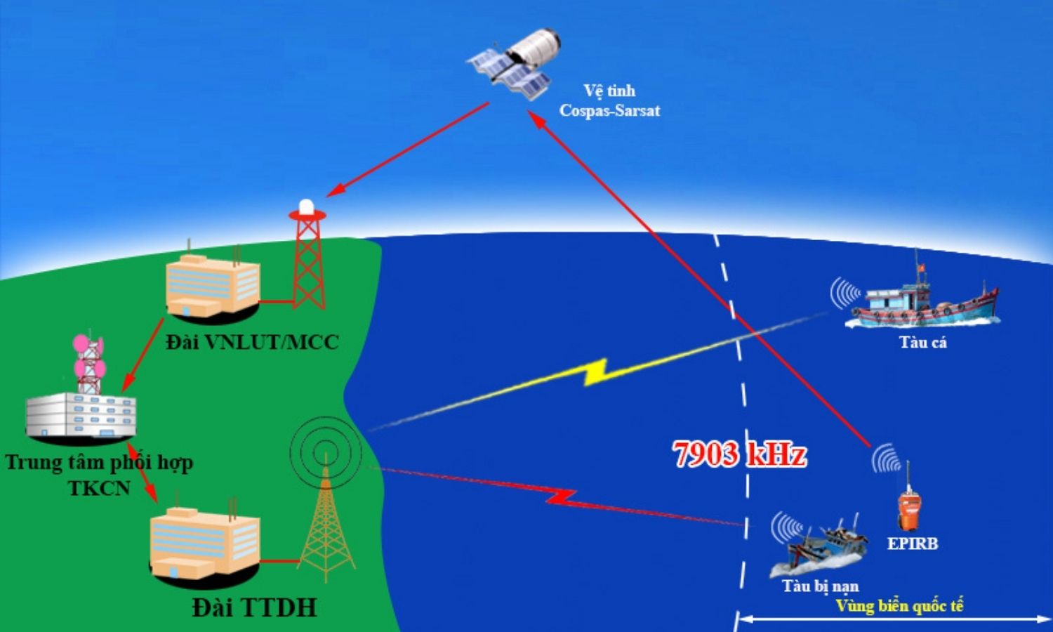
Providing professional solutions, equipment, radar systems, and naval combat systems for search and rescue and a variety of missions... read more

Providing solutions and processing remote sensing data in the medical field.
• Uses satellite data to show the fastest route... read more